Excerpts from Jim Conrad's
Naturalist Newsletter

from the January 8, 2012 Newsletter issued from Hacienda Chichen Resort beside Chichén Itzá Ruins; limestone bedrock; elevation ~39m (~128ft), N20.675°, W88.569°; central Yucatán state, MÉXICO
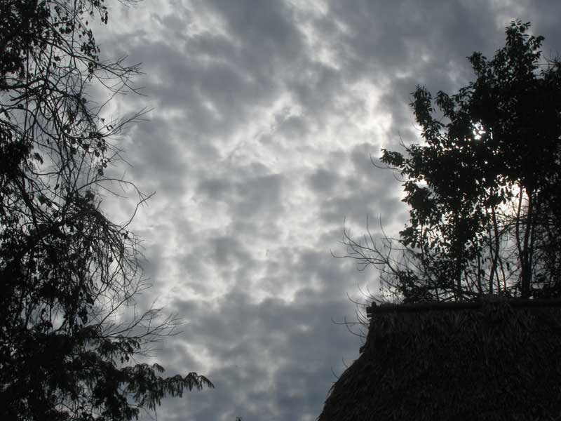
STRATOCUMULUS STRATIFORMIS CLOUD
One mid-afternoon this week a blanket-like cloud bank moved in from the east. It'd been a sunny morning so air next to the ground was warm. The warmth bubbled upward in convection currents, disturbed the cloud cover, and resulted in the cloud formation shown above.
To a Northerner that might look like a cold, late afternoon, winter sky but in fact when I took the picture it was warm, humid and balmy. Such a cloudy sky was a little unusual so far into the dry season, but not too much so. It's a thin layer, or stratum, as evidenced by the cloud-blobs' edges translucing with sunlight from above. Since the cover is continuous, even though it's irregular, I figured it was a kind of stratus cloud, and since its shiny-sided lumps looked like crammed-together cumulus clouds, I guessed that the whole formation might be a kind of stratocumulus, and that turned out to be so.
The World Meteorological Organization lists three "species" of stratocumulus: One with its lumps towering upwards; another with lens-shaped lumps, and; one described as "sheets or relatively flat patches of stratocumulus." The last one is ours, and that's STRATOCUMULUS STRATIFORMIS.
A similar-looking cloud type is that of Altocumulus stratiformis, but that type forms higher up. Its lumps in general appear smaller and the stratum is thinner, with sunlight above it passing through more easily.
In the North, general wisdom is that Stratocumulus stratiformis clouds form from the rising and breaking up of low sheets of stratus clouds, and rarely produce rain. Ours formed at the head of a rainless, dry- season front. The sky just behaves differently here.