PLANTS | ANIMALS | ECOLOGY | FUNGI | GEOLOGY | GARDENING | TOOLS
MEXICAN PLANTS & ANIMALS HOME

Excerpts from Jim Conrad's
Naturalist Newsletter
from the October 16, 2011 Newsletter issued from Mayan Beach Garden Inn 20 kms north of Mahahual; Caribbean coastal beach and mangroves, ~N18.89°, ~W87.64°, Quintana Roo state, MÉXICO
COASTAL LAGOONS
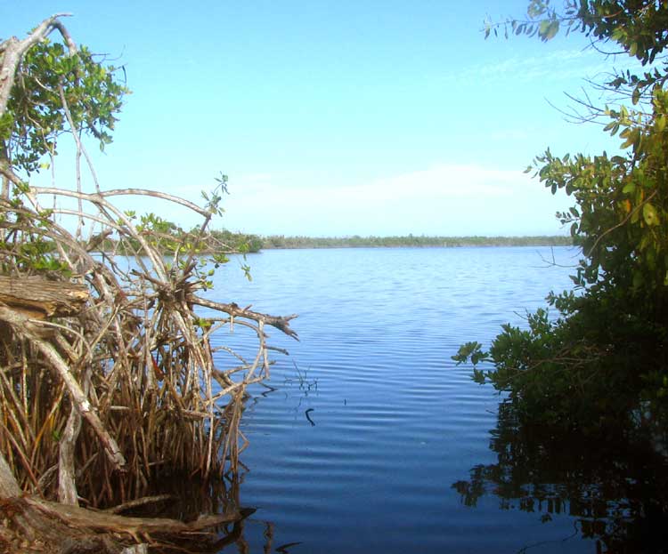
If on Google Earth you search for "Mayan Beach Garden" you'll see that just inland here all along the coast there are fair-sized lakes. Some are practically inaccessible but others are near the road and trails have been cut to them. The other day I visited the one at the top of this page.
At the left, those are Red Mangrove "stilt roots." Notice the little island a bit behind the roots. Mexican fishermen I met there told me that recently they'd seen a big flock of Flamingos on the island but the only birds I saw that day were a kingfisher and a Green Heron.
These lakes are more specifically referred to as coastal lagoons. The Google Earth view from space makes it easy to imagine how such lagoons form. You start out with an irregular shoreline, then the ocean's currents always flowing in the same direction deposit sediment across any bay's mouth, closing it off, forming a lagoon. The sand ridge we occupy at Mayan Beach Garden is such a deposition, and there are lagoons not far inland.
Coastal lagoons typically fill with brackish or saline water. Salinity of water in our lagoons tends to be low, however, since freshwater enters the lakes from subterranean rivers carrying water from inland. Still, at a certain level you get saline water and saline water intrudes during the dry season, so salinity in our lakes varies. Here at the peak of the rainy season our lagoons aren't very salty at all.