PLANTS | ANIMALS | ECOLOGY | FUNGI | GEOLOGY | GARDENING | TOOLS
MEXICAN PLANTS & ANIMALS HOME

Excerpts from Jim Conrad's
Naturalist Newsletter
from the November 26, 2017 Newsletter, with notes taken in mid October near Tepotzlán, Morelos state, MÉXICO
Elevation about 5315 ft (1620m), at 18°59′07″N 99°05′59″W
MOUNTAINS AROUND TEPOTZLÁN
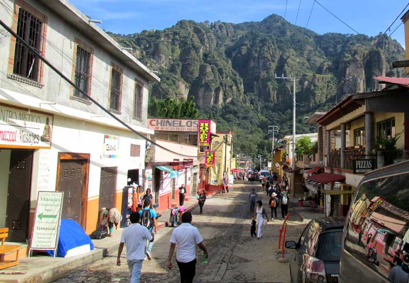
During mid October when I visited a gardening friend near Tepotzlán, Morelos, in the highlands just south of Mexico City, it was a pleasure to see the area's mountains. The Yucatan is so flat that I get hungry to see mountains. Below, take a look at the mountain called Tepozteco as seen from downtown Tepotzlán, looking north:
A friend and I climbed Tepozteco to visit an Aztec pyramid atop the mountain, but once we got there the entrance was barred because of instability caused by the recent earthquake. Earthquakes are common occurrences in this area, which lies within the Central Volcanic Belt cutting east/west across Mexico just south of Mexico City. The Belt results from two great tectonic plates grinding against one another, the friction creating rock-melting heat, which sometimes finds release in volcanoes. Major volcanoes occur in a line there inside the Belt. From east to west there's Orizaba, Popocayépetl, Nevado de Toluca, Paricutín, Nevado de Colima, and others. From Tepotzlán, Popocayépetl could be seen on clear days, with considerable smoke rising from its beautiful, snow-covered, symmetrical peak.
In the above picture of Tepozteco you can barely see that the mountain's exposed walls are layered. Below, the layering can be better seen in hills visible from my friend's front yard:
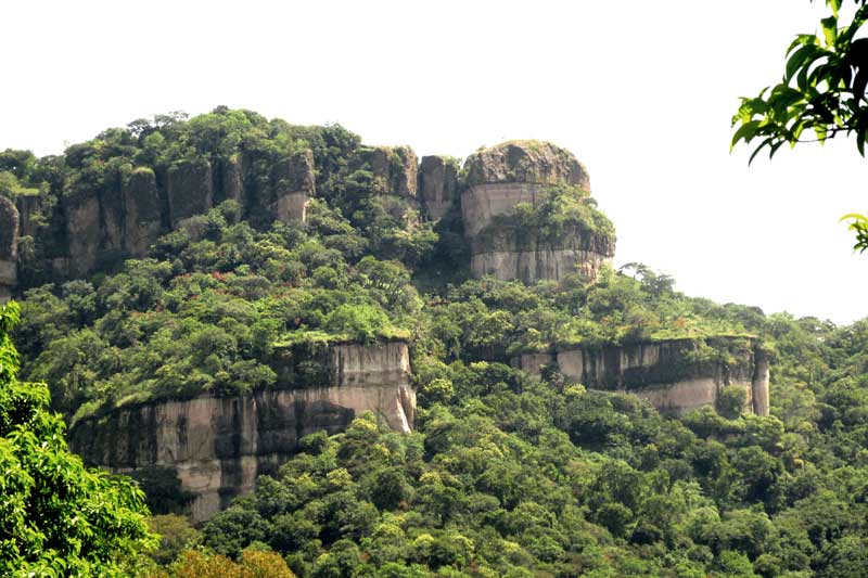
I had assumed that the layers were composed of volcanic ash, the different strata being deposited during volcanic eruptions over long periods of time. However, on the Internet I was lucky to find a 1977 document by Héctor Ochoterena F. entitled "Origen y Edad del Tepozteco." It can be downloaded for free, in PDF format, from a Scielo.Org.MX website page.
In that work, Ochoterena's English summary says that Tepozteco's layering "... was formed during the Lower Pliocene by turbulent streams which drained the high valley of Mexico southwards."
So, the layers are not volcanic ash and other ejected igneous material deposited during nearby volcanic eruptions, but rather sediment deposited by streams running off the elevations where volcanic ejecta have accumulated. The ejecta was carried in the streams and deposited downslope, to the south, as sediment. Ochoterena further says that the deposition constituted the middle part of an alluvial fan in some places 500m deep (1640ft) in alluvium.
This deposition of this alluvium in the Tepotzlán area took place during the Lower Pliocene, which Ochoterena places at 11.4 to 12 million years ago. Later, water eroded valleys that cut through the alluvium. Layering in the valleys' walls result from the alluvium having been deposited from different eruptions, under different depositional environments. The view in the upper picture from downtown Tepotzlán is seen from the bottom of one of those valleys.