PLANTS | ANIMALS | ECOLOGY | FUNGI | GEOLOGY | GARDENING | TOOLS
MEXICAN PLANTS & ANIMALS HOME

Excerpts from Jim Conrad's
Naturalist Newsletter
entry dated April 3, 2023, issued from near Tequisquiapan; soil derived from lithified sediment from nearby hills composed mostly of igneous rhyolite; elevation about 1,900m (6200 ft), Querétaro state, MÉXICO
(~N20.55°, ~W99.89°)
SHEEP HOOVES, DRY-SEASON POLYGONAL CRACKS, & EROSION
Historically this area has experienced a warm rainy season beginning in early May and ending in late October or so, when a mild dry season began. Wikipedia's Spanish page for Tequisquipan gives the annual precipitation of the town of Tequisquiapan as 754mm (~30 inches), and average daily temperature 17.2°C (63°F). My experience in the region is that the rainy seasons are not developing as they used to, and the dry seasons are exceedingly dry, starting earlier and lasting longer, with months passing without any rain at all. However about two years ago Tequisquiapan experienced historic and very damaging flooding.
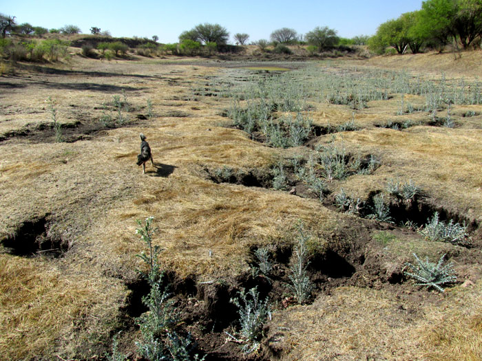
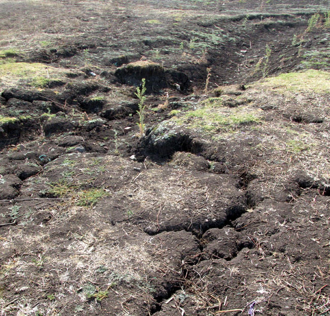
In that context, I have wondered about the erosional patterns shown above. That's a shallow, usually dry waterway outside of town. The waterway banks are vegetated mostly with Smooth Mesquite, and the uplands all around with cactusy scrub. The pale-blue-green plants occupying the eroded channels are pricklypoppies. My first impression was that the daily passages of mobile herds of sheep up the waterway may have induced the erosion.
Above, in the same area seen in the top picture, sheep hoof prints dominate the image's top, right corner, while polygonal cracks are forming elsewhere. In the 2022 work by Gabriel Minea and others entitled "Impacts of Grazing by Small Ruminants on Hillslope Hydrological Processes: A Review of European Current Understanding," it's found that "Where excessive, or prolonged SRs (sheep and goats) grazing is experienced, soil degradation and hydrological processes, such as leaching of nutrients, soil compaction due to tramping, and soil erosion occur." Above, both sheep trampling and the formation of drought-caused polygonal cracks appear capable of forming short trenches in which water running downhill -- toward the picture's top, right -- could initiate erosion and gullying.
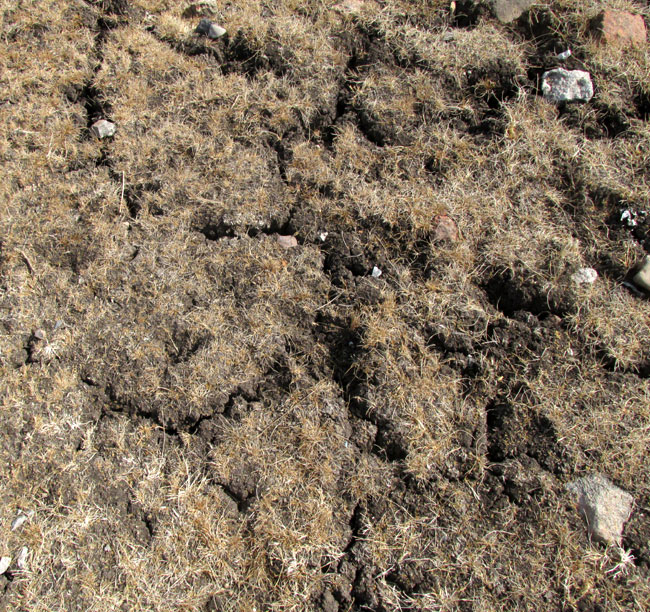
Farther downstream, where sheep were less commonly herded, as seen below -- where again downstream is toward the top, right -- polygonal cracks provided the best chances for gullying to be initiated:
Polygons form in many contexts, from cells in honeybee combs to scales on crocodile snouts, for varying reasons. The Wikipedia page on Mudcracks explains that drying mud contracts, and the contraction causes interior strain among soil particles. Cracks develop to ease the strain, and eventually the cracks join up. The formation of mud cracks into polygons is a complex concept of physics, taking into account that the strain is greater at the mud's drying surface than lower down. The interconnected network of cracks are referred to as tessellations.
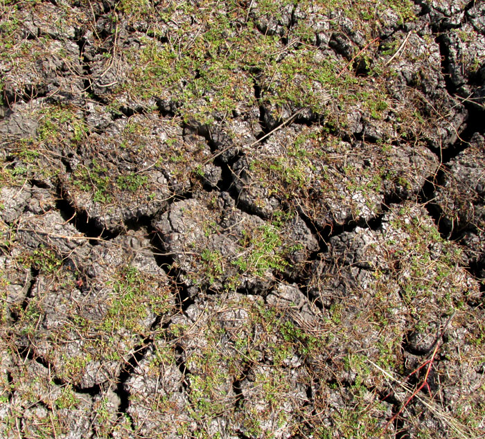
The cracks can become so wide and deep that we animals who step into them can injure ourselves.
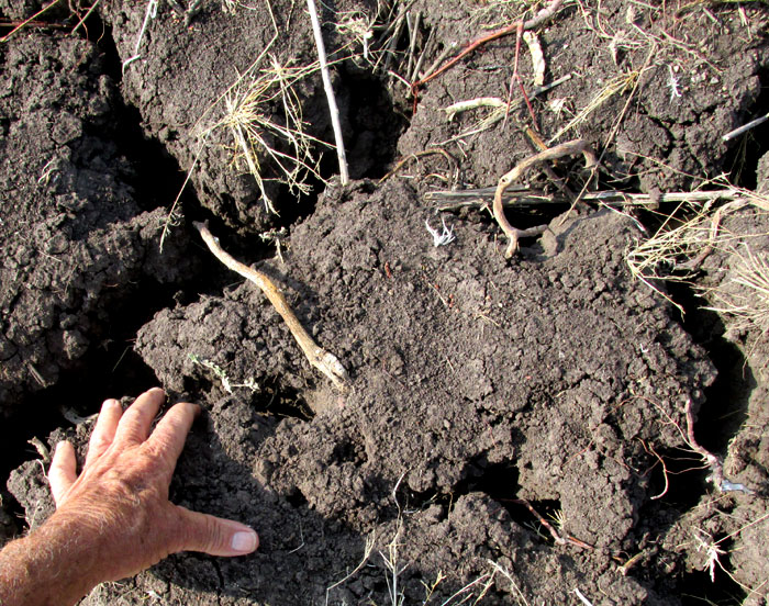
Above, you see cracks developing into small streams, or rills, which unite with other rills to form a fast-eroding gully.
Downstream, a small reservoir quickly fills with sediment from this erosion, and periodically must be removed by machines. My impression is that roaming livestock are partly to account, but also natural crack-forming. If the waterway's vegetation wasn't so overgrazed, the interconnecting networks of plant roots would hold the soil in place better.