PLANTS | ANIMALS | ECOLOGY | FUNGI | GEOLOGY | GARDENING | TOOLS
MEXICAN PLANTS & ANIMALS HOME

Excerpts from Jim Conrad's
Naturalist Newsletter
Entry from field notes dated September 1, 2023, taken in rock quarries along the southern boundary of Los Mármoles National Park in the Eastern Sierra Madre mountains, Hidalgo state, MÉXICO
GEOLOGY ALONG MÁRMOLES NATIONAL PARK'S SOUTHERN BOUNDARY
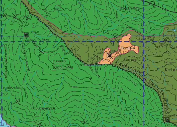
Above, a small portion is shown of the Mexican Geological Service's geology map of 2001 entitled Carta Geológica-Minera San Nicolás F14-C59 Hidalgo. The heavy black line snaking across the image from top, left to bottom, right designates the Nicolás Flores Thrust Fault, in Spanish known as the Cabalgadura Nicolás Flores. A fault is a fracture or zone of fractures between two blocks of rock. If you place a crisp cracker atop another crisp cracker and, keeping them together, break them apart along the same line, and shift the position of the two broken halves relative to one another, the broken line between them represents a fault. Wikipedia has an illustrated page about geological faults in general.
Thrust faults such as the one highlighted above are special faults forming when geological forces push on large areas of rock strata from the side, while there's some kind of resistance to the pushing on the opposite side. If the pushing force is great enough and the rock strata are pliable enough, they will fold in various ways, as shown on our page profiling a roadcut through the Soyatal-Mezcala Formation in Querétaro state. However, if the overall strata are brittle enough, they'll break along a fault zone and one side of the fault will be shoved, or thrust, atop the other side. That's a thrust fault, as illustrated on Wikipedia's Thrust Fault page.
In geology map symbology, thrust faults are represented as black lines with saw teeth along one side pointing toward the higher, overthrust mass. Therefore, in the above map, strata from the lower left were pushed above strata at the right. Numerous thrust faults occur in the park, and the Nicolás Flores is fairly typical.
In the above map, outcropping rocks in the dark green area dominating the map are labeled KaceCz-Mg, while outcropping rocks in the brownish zone on the right-hand side of the thrust fault are labeled KtcLu-Cz. Both rock types are upper Cretaceous in age, having formed around 67 million years ago. Rocks in the green area are a little older than those in the brown area. Rocks on both sides of the thrust-fault are overwhelmingly composed of limestone and shale, with many intermediate states and having varying amounts of calcium carbonate. One often sees shaley limestone, and limy or calcareous shale.
The calcium derives from shells of microscopic organisms which settled to the ocean's bottom, which later was uplifted to form these Mexican highlands. Though the rocks forming the mountains are around 67 million years old, the mountains themselves owe their presence to uplifting, faulting and erosion taking place much later, about 23 million years ago.
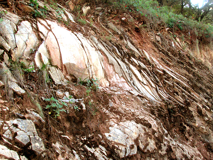
The Nicolás Flores Thrust Fault is not a single clean break but rather a narrow zone of many fractures running in many directions, with the sides of each fracture having slipped at different angles relative to one another. Here's an example of a rock quarry wall just west of Jagüey on the road between Trancas {on maps designated "Morelos (Trancas)"} and Nicolás Flores, at N20.8064°, W99.2335°:
At the picture's left, note the tilting limestone strata dipping downward toward the lower right. A little into the picture the layers begin bending downward more steeply. Even farther to the right they fracture and jumble, losing their identities. Then at the picture's lower, right other strata appear doing their own thing. This is a complex fault zone which is hard to interpret, other than to say that considerable pressure and grinding accomplished various kinds of rock strata deformation. This kind of geological confusion is much seen all along the thrust-fault zone.
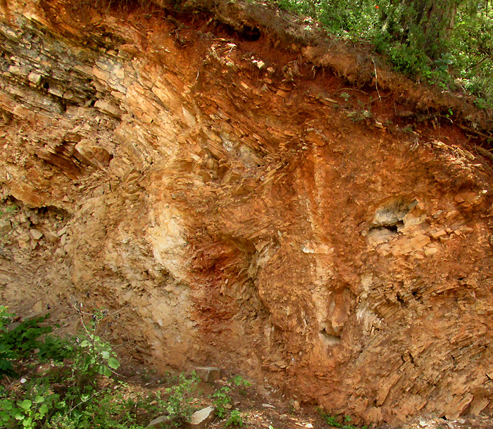
At another location maybe 1km west of Puerto de Piedra (N20.82°, W99.21°) in the wall of a small quarry another kind of deformation had taken place, producing what's shown below:
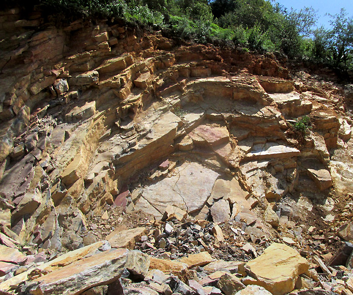
This appears to be calcareous mudstone of the Tamabra Formation (the map's KaceCz-Mg). Instead of viewing the strata in cross section as in the earlier picture, here they are viewed at an angle exposing brief outcroppings of strata upper surfaces. All the strata are bent a little, but not enough to shatter into gravel and powder. Rocks breaking off the various layers display flat tops and bottoms, but irregularly fractured sides. Some rocks are large enough to serve as flagstones for pavements. In fact, beside the above quarry, someone had piled up these retrieved flagstones:
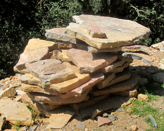
Some very modest houses in this area stood next to impressive flagstone-paved patios. Here's a bed a little too curvy for flagstones: