 From the Zapotitlán Desert I return downslope and
eastward to the bustling city of Tehuacán and take a second-class bus on the old road
toward Oaxaca City. Always running southeast, we keep on the floor of the Tehuacán
Valley, a magnificent geological rift with the northern Oaxaca highlands to the right and
west and, like a wall extending into the clouds, the imposing Eastern Sierra Madres on the
left.
Forty kilometers (25 miles) southeast of Tehuacán we pull into the little town of Coxcatlán for a tamale snack. Coxcatlán is world famous for a cave just outside town where the oldest remains of corn, or maize, were found -- primitive nubbins no larger than the last joint of your thumb. Another 23 kilometers (14 miles) and we reach Teotitlán.
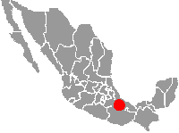
At Teotitlán a narrow secondary road breaks off the main highway and snakes with difficulty up the broken Eastern Sierra Madre wall, into the clouds. Buses avoid this road so I buy passage in a car and sit next to a small Indian woman doing the same. She tells me that this part of the Eastern Sierra Madres is called the Sierra Mazateca. People who live here are mostly Mazatec, she says, and they speak Mazatec in their homes, though they are trying to learn Spanish to be less backward. I say it would be a shame if the children of this land forgot the language of their ancestors. She turns to the driver and says that people just don't understand what it's like being an Indian, and she ignores me for the rest of the trip. The land of the Mazatec occupies not much more than a mountain valley or two, completely surrounded by the much more populous Mixtecs.
UP THE WALL TO SQUAT
Around Teotitlán the valley floor is surrounded by little ranchos, and irrigated sugarcane is the main crop. Irrigation gives the valley floor a lush, rich feeling, but not five minutes out of Teotitlán irrigation ends and abruptly we're in scrubby thorn forest presided over by órgano cactus.
Higher up, scrub gives way to oak and pine forest with Spanish moss dangling from trees. Entering the clouds, suddenly it's cold and wet, and now that the land is level enough for people, desperate-looking villages appear with barefooted Indians walking along the road traveling between them. Chilly air gushing through the car window smells fresh, muddy, infused with various manures, and woodsmoke. Steep slopes all around are mantled with weedy cornfields. Vegetation is dark and glistening after a rain that's just ended.
There's no place to put a tent here. Everything is steep-sloped, and what little level land there is, is occupied by buildings.
Service ends at the mud-mired, congested, odoriferous town of Huautla de Jiménez claustrophobically wedged into a steep-walled valley. I find a pickup truck heading farther east and for about 15 kilometers (nine miles) stand crammed in the truck's back with about 15 other travelers. With all the stops, loading and unloading, and running out of gas, the trip takes a couple of hours.
San Juan is as far as the truck goes. I'm told that now the deteriorating road stays level for a few kilometers, then starts its descent toward the Gulf lowlands. It's getting late so in San Juan I look for a room, or even a level spot to rent for the tent, but people are wary of me and nobody wants to have anything to do with me. I begin walking along the road hoping a tent site turns up, but there's nothing.
After a few kilometers the road comes to a valley-size a gap between two mountains. Dark, dense, wind-driven cloud-billows gush upward through the gap from the other side, from the Gulf lowland side, then immediately dissipate, like steam from a teakettle, as they rush through the gap. At the gap the road dips steeply and disappears into heavy cloud-fog. The wind is wet and cold, but sometimes for a second or two warm currents wash around me and I think I can smell in them tropical odors from down below, the odors of rank herbage, moldy forest litter, ripe fruit... This is the highland rim of the Gulf Lowlands exactly...
Through the cloud fog I can barely see that to the right a narrow peninsula of level land extends a bit into the gap. However, all the level spots on this peninsula are occupied by rough log cabins strewn among pines.
With darkness growing all I can do is to enter the raw-looking settlement and hope that I can place the tent next to their cabin. It takes a while to find someone who speaks Spanish, not just Mazatec. Finally a Spanish-speaking man comes to a hut's door holding a Bible, assuming I'm a missionary. He hears my story, laughs with relief, and says I can spend the night in the settlement's open-walled meeting hut. He says the settlement is called Loma de la Plaza and he refuses to accept money, explaining that they're all squatters, so technically the land is as much mine as theirs.
OVER THE RIM
Just before dawn I'm awakened by crowing roosters and the pat-pat-pat of women forming tortillas by hand. Soon comes the odor of woodsmoke, then of baking tortillas, and of steeping coffee. The wind has died and clouds no longer sweep through the gap. But it's cold and wet so in dawn's semidarkness I thank my hosts through a closed door, then go onto the road. For a few minutes I stand at the exact spot where the road begins its descent toward the Gulf.
There's no traffic at this early hour but several very humble looking farmers silently trudge past carrying machetes and a few bound-up tortillas. They are on their ways to distant cornfields for a day of chopping weeds. They do not look up to see the clear blue sky, nor do they look down the valley opening toward the east where distant fog in the lowlands pools like quicksilver. They just look at the few feet of ground right before them, and maybe I would, too, if I were in their place. I hope they at least hear the Brown-backed Solitaire filling the valley with its effervescent tones.
As I descend, the narrow, broken-up road keeps the mountain slope on its left and the deep, V-shaped valley on the right. The road follows the mountain's folds, deep into hollows, then out to make sharp bends around razorback ridges. Landslides are frequent, sometimes avalanching onto the road, sometimes part of the road itself sliding into the valley.
The road is mud and gravel, and one and a half lanes wide. Waterfalls cascade right onto the road's surface, flow across it and gush into the valley below. In some places the road sags into quagmires of liquefied mud where epic battles between people and mired vehicles clearly have taken place. Often the roadside is cluttered with shattered, uprooted trees bulldozed just far enough to be out of the way and I smell their splintered wood and the mud.
BIRDS OF THE UPPER SLOPE
All morning the birds remain quiet, maybe waiting for midday sunlight from between the peaks, though for a few seconds some Ravens appear mobbing a Red-tailed Hawk. For a long time I only hear Brown-backed Solitaires, one in each valley, and no valley here would be a valley without its solitaire.
Late in the morning I spot movement in shadows beneath bushes below the road and it's a Blue Mockingbird bathing in rainwater pooled on a flat limestone rock. The bird's tail is so broad and scalloped that at first I think it's an ani. A little later a Common Bush-tanager comes nervously gleaning the undersides of bush leaves, as if it were a warbler.
After three hours of fast-descending easterly walking, high-elevation Sweetgum trees drop away leaving a scrubby woods in which umbrella-shaped Cecropia trees appear, one of the main indicators of humid, tropical forests. Soon afterwards tiny villages turn up alongside small banana plantations, and Brown Jays, real "weed birds," come complaining with their loud, grating jay-calls.
By noon I'm disappointed because I'm getting into the humid lowlands so fast. I'd wanted a good hike through the high Sweetgums, but now they're gone for good... Needing food I walk into a village hanging on the slope to buy food and find only one man willing or able to speak Spanish.
SLASH AND BURN
There's not a single spot of original forest here and the destruction increases rapidly as I descend. Generations of slash-and-burn corn growing has converted the slope forest into a patchwork, each patch corresponding to a farmer's cornfield in various stages of converting from field to forest.
This is slash-and-burn technology: The farmer "slashes" the forest and burns it, then plants his crop. The first couple of years, because of nutrients released by the burning of trees, the crop is bountiful, but then weed and insect populations build up and after perhaps four or five years the plot must be abandoned. Then another section of forest is cut and the cycle is repeated, each cycle eroding away more soil and depleting what's left.
As population density soars the cycles grow shorter so that eventually the soil can't renew itself. The patchwork becomes nothing but fields alternating with weeds and bushes, and finally so little soil remains among the outcrops of bedrock that everything must be abandoned, and no forest will return there.
In mid afternoon, though the temperature is only 29.5° C (85° F), the humidity is overwhelming. I pitch the tent on a hint of hardly level ground below the road, beneath fifteen-foot high tree ferns with dark, knobby trunks thick as my leg. Mosquitoes raise a high whine outside my netted door as I lie panting, wondering if rain tonight will wash through the tent.
BIRDLIST #11-a
Here's the Official List for this day of slowly walking along the highway, dropping in elevation from around 1,600 meters (5,250 feet) to around 1,400 meters (4,600 feet)
MEXICO: Oaxaca; 5 to 10 kms east of San Juan, ±16 kms east of Huautla de Jiménez, on road between Teotitlán and Tuxtepec, some 20 air-kms east of Teotitlán; elev. 1400-1600 meters (4600-5200 feet) in the Sierra Mazateca; borderline cloudforest, with Sweetgums and weedy cornfields
permanent resident
winter resident
not found in the USA
GULF COAST SPECIAL
- Turkey Vulture
- Red-tailed Hawk
- RUFOUS-TAILED HUMMINGBIRD
- White-eared Hummingbird
- Common Raven
- Blue Mockingbird
- BLACK ROBIN (GLOSSY-BLACK THRUSH)
- Brown-backed Solitaire
- Rufous-capped Warbler
- Townsend's Warbler
- Wilson's Warbler
- Ovenbird
- YELLOW-WINGED TANAGER
- Common Bush-tanager
GULF-SLOPE SPECIALTIES
The hot, humid lowland between the Eastern Sierra Madres and the Gulf of Mexico, which includes northern Chiapas, harbors the greatest diversity of bird species among all of Mexico's biological regions. Until now we've not seen a single species that in Mexico is restricted to the Gulf lowlands.
But in this list we have three "Gulf-Coast specialist" species -- the Rufous-tailed Hummingbird, Black Robin and Yellow-winged Tanager -- which amounts to 21% of the list. As we drop lower the percentage should increase. Often species restricted to Mexico's Gulf coast extend on southward through the Caribbean lowlands of Central America into northern South America. Now we're getting into country that's famous not only for its quantity of birds but also its exotic variety, and the more we descend the better it'll get.
NEARING THE LOWLANDS
Continuing to descend the next day, the vegetation grows more and more hacked up. So much of what appears to be forest is actually coffee plantations. Though I can always turn around and see the blue peaks behind me, now the air is hot and humid. Sometimes the slope on which the road runs bulges into little valleys with some flat land occupied by pastures and occasional small villages.
Sometimes, to rest from the heat, I step into a coffee plantation's deep shade. The coffee bushes, ten feet high, bear dark green leaves opposite one another in neat ranks, and their beans are green, turning red. Coffee is a pretty plant, but it's of little use to birds. However, coffee does best in the shade, so interspersed among the coffee plants are taller "mother trees," and these sometimes keep coffee plantations from being ecological deserts.
By midday the much disturbed vegetation is strongly tropical; there's Cecropia, coffee, banana, avocado, Monstera vines with their huge, glossy, deep-fingered leaves, giant bamboo, and even Mamey and Chicozapote trees, the producers of the tropic's sweetest fruits. However, I'm still descending, and mountain slopes tower on every side. The slopes are smoky with haze and more patched than ever. Only occasionally do large trees appear, often Strangler Figs, and their great, horizontal branches bear nothing less than luxuriant gardens of epiphytic ferns, orchids, translucent Peperomias, mosses, lichens, bromeliads, Night-blooming Cereus cactus and other tree-living cacti. Often birds are spotted foraging in these arboreal gardens. Along the road, red-flowered mimosas draw hummingbirds moving so fast I can't identify them. Yellow-flowered Crotalarias stand eight feet high. Yesterday's world of blue-lighted Sweetgums and chill feel a hundred years away.
Seven Montezuma's Oropendulas sail with wide, rusty wings and yellow-tail-tips showing nicely against the green slopes. Their strangely echoic chortles are like silvery bubbles floating up through the thick haze. Deep within the shadows of a twenty-foot heap of weeds, vines, and bushes, there's a Crimson-collared Tanager, a black-satin bird with a blood-red cape, as exotically colored as possible, yet a lover of weeds.
From all directions come sounds of machete chops, a sort of stereophonic chewing of the landscape. On the road I'm constantly passing people loaded as heavily as possible with firewood. This firewood comes from isolated spots far away, for all trees within sight don't burn well, being wet inside. Oak and pine burns, but not Cecropia or madrone. Oak and pine surely once dominated here but generations of firewood gatherers have now pushed those species into the remotest corners. And even those remote corners are not safe, for people made of corn and beans must have fire. This fractured habitat must be perfect for Wilson's Warblers, though. My impression is that every fifth bird is one of them.
The Indians here fear me. As I pass roadside villages mothers grab their children from the roadside and run away, not looking behind them. In the town of San Bartolomé, cocooned in ghostly woodsmoke, I try to buy a meal at a roadside kiosk but the woman doesn't react to my Spanish at all, just stares and shakes her head. Finally, at the door of an old church with a shiny new tin roof I buy boiled chayote, a kind of green, spiny squash, from a little girl with a towel-draped basket of them. Around her are old women selling bright plastic dishpans, cups, and buckets. Inside the church it's dark, but down at the end candles are burning.
Though the men usually dress in ragged "street clothes," the women wear two-layered dresses. Outside there's a white smock-like piece reaching the knees, trimmed in multicolors between the waist and the knees. Beneath this there's a flowing "gown" reaching the feet, with a white background adorned with broad, horizontal bands of bright colors.
 The
walls of houses here are made of slender, vertical poles, and have tin roofs. Though
bean-cooking fires are often burning inside there's never a chimney. Woodsmoke drifts from
beneath the roof leaving the ceiling glossy black with soot. It's coffee-bean-drying
season. Wherever there's enough level ground, a concrete court has been built, and here
coffee beans are spread and dried. Beside many huts, beans are strewn on straw mats.
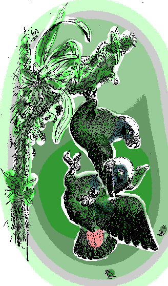
At dusk I steal into an abandoned coffee plantation, with security very much on my mind. I am intensely focused on watching for someone following me, on not being seen, of choosing a random spot and camouflaging the tent as best I can. As darkness falls I hear parrots in the "mother tree" above me and stick my head from the tent's door. Two White-crowned Parrots are fighting, one dangling from a Peperomia-covered limb by a single toe while the other attaches itself by the beak to its adversary's wing, and what they're saying is clearly parrot-cussing...
BIRDLIST #11-b
Here's the Official List for the second day of hiking downslope:
MEXICO: Oaxaca; 10 to 20 kms east of San Juan, ±25 kms east of Huautla de Jiménez, on road between Teotitlán and Tuxtepec, some 30 air-kms east of Teotitlán; elev. 1000-1200 meters (3300-3900 feet) in the Sierra Mazateca; tropical deciduous forest, coffee plantations, pastures, with Cecropia and viney aroids
permanent resident
winter resident
not found in the USA
GULF COAST SPECIAL
- Black Vulture
- Turkey Vulture
- Sharp-shinned Hawk
- Roadside Hawk
- PLAIN CHACHALACA
- Golden-fronted Woodpecker
- RUFOUS-TAILED HUMMINGBIRD
- WHITE-CROWNED PARROT
- VIOLACEOUS TROGON
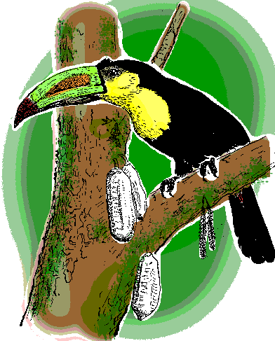
- Keel-billed Toucan
- Squirrel Cuckoo
- Groove-billed Ani
- Boat-billed Flycatcher
- BROWN JAY
- BAND-BACKED WREN
- Blue-gray Gnatcatcher
- Nashville Warbler
- Townsend's Warbler
- Wilson's Warbler
- American Redstart
- MELODIOUS BLACKBIRD
- Great-tailed Grackle
- MONTEZUMA OROPENDOLA
- CRIMSON-COLLARED TANAGER
Yesterday, just beginning the descent into the Gulf Lowlands, we celebrated 21% of our species being Gulf-Slope specialties. In this second list, taken hundreds of feet lower down the slope in habitats with much more of a tropical element, 38% of the species are Gulf-Slope birds. Northern migrants overwintering here account for 21% of the species. With all the habitat destruction so obvious around me, it's clear to see why the populations of so many neotropical migrants are diminishing.

