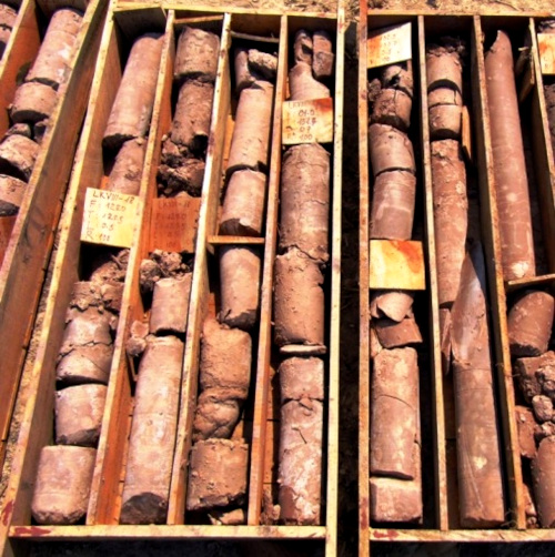
 Drill cores; public domain image courtesy of "BacLuong" made available by Wikimedia Commons
We know what's below the loess capping our Loess Hills because there's been a great deal of geological drilling all through the area. Drills bring up cores of the material drilled through, like those shown at the right, so the nature of the drilled-through material can be examined directly. You may like to freely download a PDF describing the strata below the loess in Mississippi.
At Vicksburg, Mississippi, if you stood atop one of the higher spots on the big loess-capped bluff there, and you began drilling straight down, cores tell us that here's what you'd find:
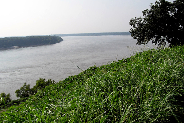 View across the Mississippi River from a loess-topped bluff at Vickburg, Mississippi; image courtesy of Shawn Lea
During the first 120 feet, you'd pass through loess. Then the drill bit would cut its way through about forty feet of gravel, sand, and silt, an assemblage of strata known as the Citronelle Formation. The Citronelle was deposited approximately 1.5 to 3.7 million years ago. At a depth of about 160 feet, you'd run into a chocolate-brown, gummy, partially hard clay known as the Bucatunna Formation estimated to be about 30 million years old.
Below the gummy, chocolate-brown Bucatunna, at about 190 feet deep, there's the Byram Formation, with interbedded layers of sand, shell, clay, and nodular limestone. The Byram is world-famous for its variety and quality of fossil mollusks (they pretty much look like bleached modern sea shells). Note that with this nodular limestone, for the first time we're hitting real rock.
Below the Byram, at about 220 feet deep, there's the Glendon Formation with its limestone (real rock indeed!) and thin, interbedded marls. Then our drill enters the Mint Springs Formation. In the Byram, Glendon and Mint Springs Formations you can find fossils of sharks, rays, bony fish, and dugongs (similar to manatees), but no whales.
Deeper and deeper we drill, down through the Forest Hill Formation and the Yazoo Clay Formation at about 350 feet, in which you can find fossils of whales and sharks. Then right below the Yazoo Clay there's the Moodys Branch Formation, which also has its whales and sharks and, like the above Byram, is world famous for its fossil mollusks. Note that each formation we pass through is a bit different from the last, each has its own unique history, and, always, the deeper we dig, the longer ago it was deposited -- the older the material becomes.
Below the Moody's Branch Formation we drill through many more formations, each with its characteristic layers of stone or sand or clay or whatever, and each older than the last. At about 10,000 feet the drill chips into rocks born of sedimentation occurring in the bottom of a warm, tropical sea occupying the area in the neighborhood of 120 to 130 million years ago. These rocks are the geologists' "Lower Cretaceous," deposited when dinosaurs dominated Earth's land surface, and flowering plants were just appearing. We'll not drill through any dinosaur bones, however, because o what's seen below:
 Our area's position on the Earth 120 million years ago, during the Lower Cretaceous; this is a portion of a copyright free image by Christopher R. Scotese and others of the PALEOMAP Project made available by Wikimedia Commons
The above map show that when sediment was deposited to form our deeply buried Lower Cretaceous rocks southern Mississippi was covered with ocean water. These rocks may bear fossil seashells, but not dinosaur bones. The map also shows that at that time plate tectonics had not yet separated the continents as far from one another as now they are; Africa lay right off the coast of Cuba, Greenland was stuck to North America, and Europe wasn't too far offshore from eastern Canada.
At maybe 14,000 feet deep -- over two and a half miles -- the drill penetrates rocks around 245 million years old, rocks constituted of minerals deposited very long before dinosaurs existed. Eventually there are rocks billions of years old, not millions, and they're not formed of material deposited by wind or water, but rather have remained deep inside the Earth ever since the Earth came into existence as a planet some 4.7 billion years ago.