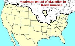
If you live in the area indicated by the map at the right as the maximum extent of glaciation in North America, at first glance your local geology may seem flat and monotonous. However, you may have nearby geological features worth visiting and learning more about. For example, there may be something like what's shown below:
THE "ICE AGES"
The Earth has been experiencing ice ages for over two billion years -- 2,000,000,000 years. The first major one was caused by the first photosynthesizing organisms releasing oxygen into the atmosphere. Between 750 and 600 million years ago more deep freezes occurred. In "recent times," starting about 2.4 million years ago and lasting until 11,500 years ago -- a time technically known as the Pleistocene Epoch -- various times the Earth's climate changed between very cold periods and very hot ones. During the cold periods, glaciers covered large parts of the planet, while during the hot ones they melted.
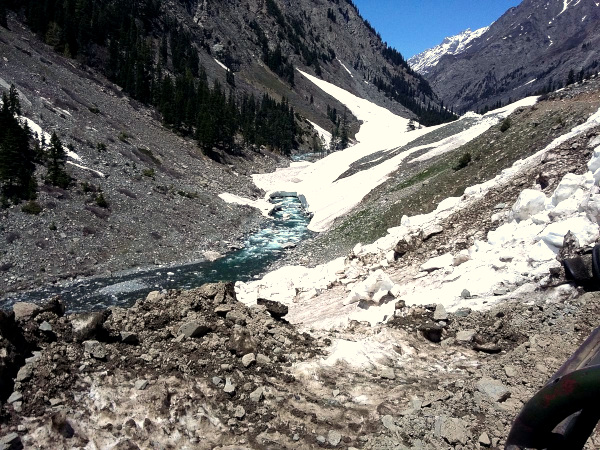 Melting glacier on the way to Kandol Lake, Pakistan; image courtesy of Ameer Boii & Wikimedia Commons
Some experts, pointing to today's polar zones and Greenland still covered with ice, say that, technically, we're still in an ice age, though near the end of it. Others say we're currently experiencing an "interglacial period," implying that possibly another ice age is due when this one ends.
It's fairly certain that changes in the amount of sunlight reaching Earth have contributed to the most recent series of ice ages. However, there may be other causes. It's not known how human-caused global warming -- atop what may be a natural warming trend -- will impact Earth's climate.
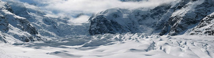
GLACIERS & FEATURES THEY LEAVE BEHIND
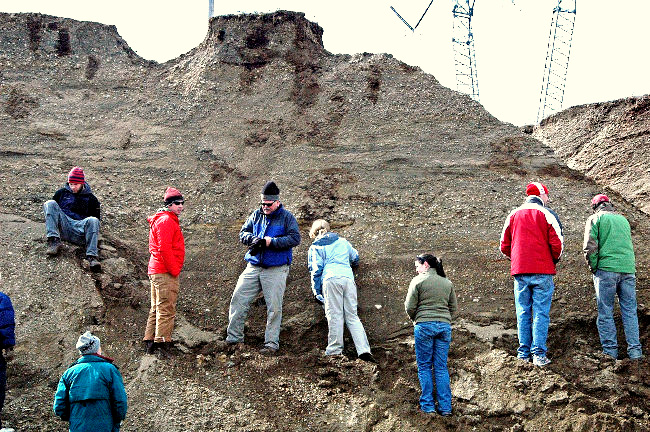
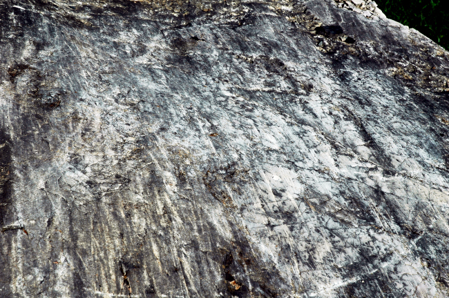 The "glacial scratches" on this large dolostone rock were produced by a glacier advancing atop the rock during the late Pleistocene about 11,700 years ago. The rock itself, known as the Dunham Dolomite, is 543-490 million years old, and occurs along the Lamoille River, in Chittenden County, northwestern Vermont, USA. Photo and information courtesy of James St. John.
Glaciers are large, land-based accumulations of ice, snow, rock, sediment, and often water, which because of the glacier's own weight may advance along a front. Glacial ice extending in continuous sheets over large areas of land, such as Greenland or Antarctica, are called ice sheets or continental glaciers. Glacial ice, which compared to rock is somewhat deformable, may advance over level or even locally elevated lands as its increasing mass pushes its lower levels forward -- like toothpaste in a tube, lying on a flat table, being squeezed from the tube as the tube is pressed from above. The advancing glacier may scratch the bedrock it passes over, as shown at the left.
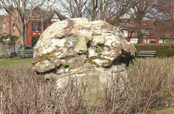 Erratic rock in Coronation Park, Crosby, Merseyside, UK; image courtesy of 'Rodhullandemu' and Wikimedia Commons
When glacial ice melts, piles of jumbled dirt, sand and gravel are left behind forming outwash plains. Often on such plains, large, isolated rocks, frequently differing in appearance from other local rocks, also are left behind. These are glacial erratics, such as the one shown at the right.
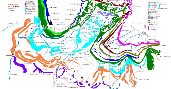
When glaciers reach a certain point before melting back, they leave piles of dirt and rock scraped and gouged from the land they've passed over. These piles are moraines, of which several kinds are recognized: There are terminal moraines, lateral moraines, medial moraines and more. The map below shows that moraines can be a significant part of the landscape.
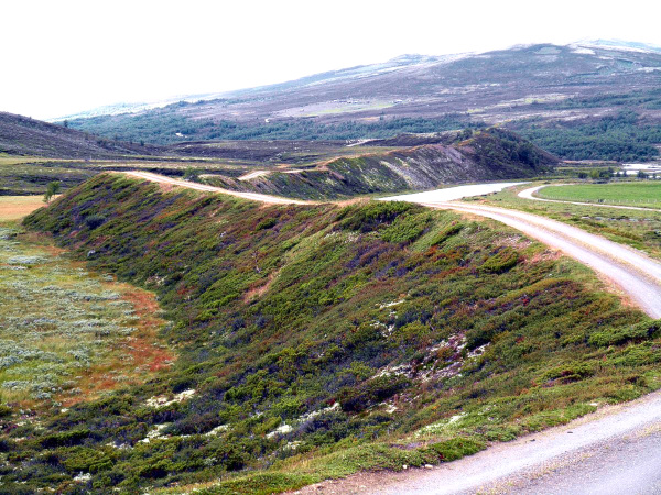 Esker in Einunndalsranden Naturreservat, Hedmark, Norway; image courtesy of 'Kaitil' and Wikimedia Commons
Often water-conducting tunnels form within and beneath glaciers, and channels develop atop the glacier, carrying meltwater. This meltwater carries a great deal of sand and gravel gouged from the landscape by the advancing glacier. When the glacier melts back, the sands and gravels that had been in the waterways remain on the land as long, often curvy ridges called eskers, as shown at the left.
Ice age deposits often appear far beyond the limits of the glaciers themselves. In the US, along much of the southern stretch of the Mississippi River, a special kind of dust, called loess, was deposited at the end of the Pleistocene, in depths of up to 200 feet (60m). You may be interested in our Web site about The Loess Hills of the Lower Mississippi Valley.
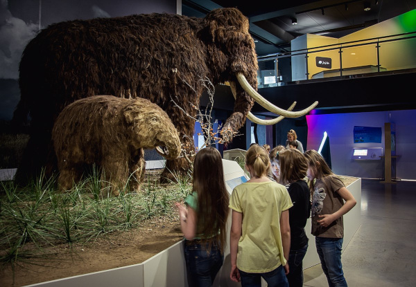 Life-size Wooly Mammoth at the Ice Age Centre in Äksi village, Tartu county, Estonia; image courtesy of the Ice Age Centre and Wikimedia Commons
Besides what's mentioned above, many other ice age features are to be looked for: drumlins, kettle lakes, kames and kame terraces, kettle lakes, and much more. In mountainous areas, ancient glaciers produce a whole other set of features, such as U-shaped valleys, arêtes and cirques. Here we've just touched the surface, not even mentioning organisms living during the ice ages, such as the Woolly Mammoth at the right. For a more complete introduction to the ice ages a good place to start is Wikipedia's Ice Age page.